Australian long range seasonal weather forecast SAM Southern Annular Mode
Climate Drivers and Outlooks
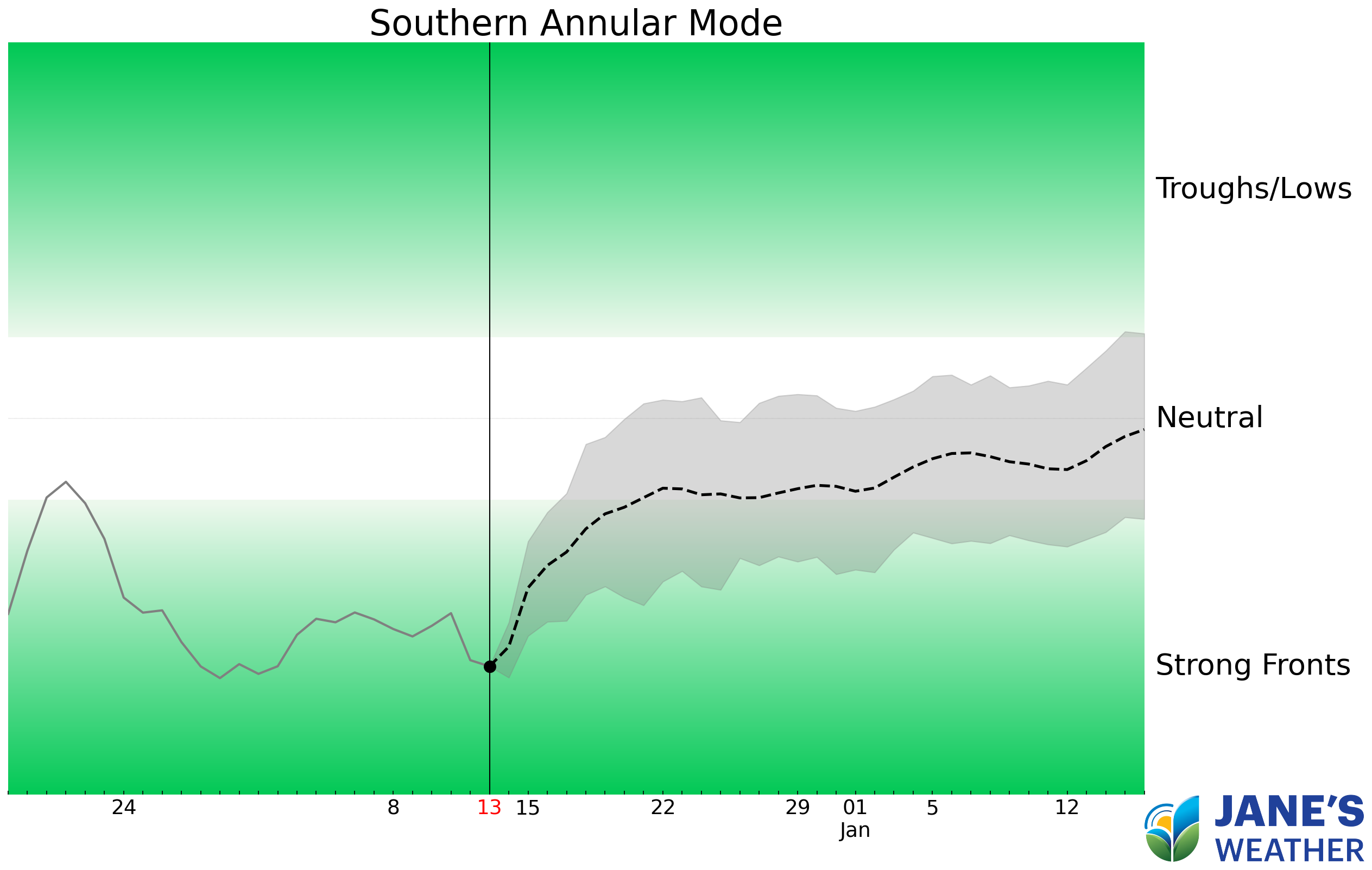
Updates daily
SAM controls our weather systems.
Positive encourages lows and troughs that can be slow moving (and when they are fed by tropical moisture they bring significant rain for those in their path), but over summer it encourages high pressure across far southern Australia, limiting how far south the lows and troughs can travel and bring rain. Positive also encourages the cold fronts to take a path over the Southern Ocean (rather than over southern Australia) limiting rain over far southern Australia at any time of the year.
Negative encourages stronger cold fronts to come up from the Southern Ocean and cross southern Australia. This helps Australia's southern coast see rain, but it only spreads inland if high pressure doesn't block tropical moisture from the Pacific or Indian Ocean connecting with the cold front.
However...
- High pressure can 'get in the way' no matter what the signal is. We can't all be covered in low pressure, there are highs in between.
- Cold fronts only hit one area. If a strong front hits Perth, it won't do much for Melbourne... if a strong front hits Melbourne, it missed Perth.
- Slow moving troughs and lows are the ones that produce the big wet weather as they bring rain to an area for longer. But the location of the low or trough has a huge impact on who gets the rain.
- For troughs: those areas on or east of the trough get the rain, those to the west miss out.
- For lows just off the east coast: heavy rain falls just south of the low, those to the north miss out.