- WEATHER
Australia
- National
- New South Wales
- Victoria
- Queensland
- Western Australia
- South Australia
- Tasmania
- ACT
- Northern Territory
Long Range Forecasts
- WARNINGS
- RADAR
- SATELLITE
- MAPS & CHARTS
- LONG RANGE
Long Range Forecasts
- CLIMATE
Climate Indicators
- NEWS
Marine Weather
Northwest Cape to Carnarvon Marine Weather Overview
 navigate by marine district
Perth Local
Kuri Bay to Wallal
Wallal to Cape Preston
Cape Preston to Northwest Cape
Northwest Cape to Carnarvon
Carnarvon to Kalbarri
Kalbarri to Jurien Bay
Perth Offshore
Mandurah to Cape Leeuwin
Cape Leeuwin to Bremer Bay
Bremer Bay to Israelite Bay
Israelite Bay to Eucla
Kuri Bay to Wyndham
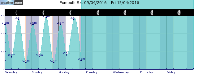
tides for Denham
tides for Carnarvon
 forecast
South to southwesterly about 10 knots. Seas: Below 0.5 metres. Swell: Southwesterly 1/1.5 metres inshore, increasing to 1.5/2 metres offshore. Outlook Monday: Variable about 10 knots becoming south to southwesterly 10/15 knots in the evening then becoming variable about 10 knots in the late evening. Seas: Below 1 metre. Swell: Southwesterly 1/1.5 metres inshore, increasing to 1.5/2 metres offshore. Outlook Tuesday: East to southeasterly 10/15 knots turning north to northeasterly in the early afternoon then becoming variable about 10 knots in the late evening. Seas: Around 1 metre. Swell: Southwesterly 1/1.5 metres inshore, increasing to 1.5/2 metres offshore. Outlook Wednesday: East to southeasterly about 10 knots tending east to northeasterly 15/20 knots during the morning then tending southeast to southwesterly 10/15 knots during the evening. Seas: Below 1 metre, increasing to 1/1.5 metres offshore north of Coral Bay during the morning. Swell: Southwesterly around 1 metre inshore, increasing to 1/1.5 metres offshore.
Issued Sun 16:00 WSTSeas: Up to 0.5m
Swell: Up to 2.0m, SW
forecast winds
Sunday: S/SW 10 ktsMonday: S/SW 10/15 kts
Tuesday: E/SE 10/15 kts
Wednesday: E/NE 15/20 kts
- locations
- Exmouth
- Carnarvon
Sun & Moon Times
| first light | sunrise | sunset | last light | moon rise | moon set | moon phase | last quarter | new moon | first quarter | full moon |
|---|---|---|---|---|---|---|---|---|---|---|
|
06:19 WST |
06:42 WST |
18:00 WST |
18:23 WST |
22:14 WST |
12:21 WST |
|
May 1 |
May 8 |
May 15 |
May 23 |
Decent rain en route to bone-dry southwest WA
14:29 AEST Welcome rain is coming to the parched southwest WA this week, possibly including Perth and Bunbury which are both having their driest 7 months on record. Many locations in the southwest will see the driest April on record, with much of this rainfall likely to contribute to May’s totals, as a cold front approaches the state on later in the week. Rainfall and thunderstorms are forecast in the Gascoyne region on Monday afternoon, before shifting to the Central West, Lower West and Central Wheatbelt regions on Tuesday.
- 12:32 AEST Wet week ahead for eastern and southwestern Australia
- 12:14 AEST A quick look at our water storages
- 16:15 AEST Signs indicating Australia's cool season arrival
- 07:00 AEST Bonsoy Gold Coast Pro surf forecast


