- WEATHER
Australia
- National
- New South Wales
- Victoria
- Queensland
- Western Australia
- South Australia
- Tasmania
- ACT
- Northern Territory
Long Range Forecasts
- WARNINGS
- RADAR
- SATELLITE
- MAPS & CHARTS
- LONG RANGE
Long Range Forecasts
- CLIMATE
Climate Indicators
- NEWS
Tasmania Sea Surface Temperature
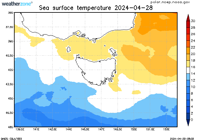
The sea surface temperature (SST) varies much more slowly than atmospheric temperatures due to the heat capacity of water. As such, the SSTs lag the atmospheric temperatures on a seasonal timescale by about 3 months. The lowest SSTs are usually observed in early Spring and the highest SSTs are observed in early Autumn.
In tropical regions, SSTs greater than 26°C are considered suitable for formation of tropical cyclones.
The data displayed in this map is the weekly average, centred on the date shown.
Enter a postcode or town name for local weather, or text to search the site. » advanced search
Snowy weekend ahead in the mountains
16:04 AEST Snowfalls last weekend were the heaviest of the 2024 winter in the alpine regions of Tasmania and mainland Australia, and more snow is coming this weekend.