- WEATHER
Australia
- National
- New South Wales
- Victoria
- Queensland
- Western Australia
- South Australia
- Tasmania
- ACT
- Northern Territory
Long Range Forecasts
- WARNINGS
- RADAR
- SATELLITE
- MAPS & CHARTS
- LONG RANGE
Long Range Forecasts
- CLIMATE
Climate Indicators
- NEWS
Marine Weather
Byron Coast Marine Weather Overview
 navigate by marine district
Canberra Lakes
Sydney Inshore
Byron Coast
Macquarie Coast
Hunter Waters
Sydney Offshore
Illawarra
Batemans Coast
Coffs Coast
Eden Coast
 most recent warnings
NSW/ACT - Thu 16:05 EDTStrong Wind Warning for Eden Coast
View all current warnings
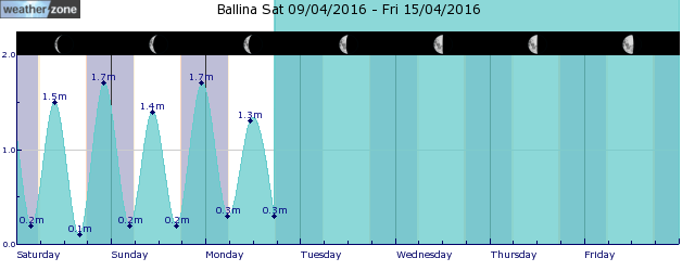
tides for Ballina
 forecast
Northwest to northeasterly 15/20 knots tending southeast to southwesterly in the evening. Seas: Around 1 metre, increasing to 1/1.5 metres offshore north of Cape Byron. Swell: Easterly around 1 metre. Outlook Friday: South to southwesterly 15/25 knots, reaching up to 30 knots in the late morning and afternoon. Winds tending south to southeasterly in the afternoon. Seas: 1/2 metres, increasing to 2/3 metres during the morning. Swell: Southerly 1/1.5 metres, increasing to 1.5/2.5 metres during the morning. Outlook Saturday: South to southeasterly 15/20 knots tending east to southeasterly 10/15 knots in the evening. Seas: 1/2 metres, decreasing to 1 metre during the morning. Swell: Southerly 2/2.5 metres. Outlook Sunday: Easterly about 10 knots tending northeasterly 10/15 knots during the morning then tending northerly 15/20 knots during the day. Seas: Around 1 metre, increasing to 1/1.5 metres inshore during the afternoon or evening. Swell: Southerly 2/3 metres, decreasing to 1.5/2 metres during the afternoon.
Issued Thu 16:05 ESTSeas: Up to 1.5m
Swell: Up to 1.0m, E
forecast winds
Thursday: NW/NE 15/20 ktsFriday: S/SW 30 kts
Saturday: S/SE 15/20 kts
Sunday: N 15/20 kts
- locations
- Yamba
- Alstonville
- Byron Bay
- Ballina
Sun & Moon Times
| first light | sunrise | sunset | last light | moon rise | moon set | moon phase | new moon | first quarter | full moon | last quarter |
|---|---|---|---|---|---|---|---|---|---|---|
|
05:34 EDT |
05:59 EDT |
19:01 EDT |
19:26 EDT |
02:02 EDT |
12:37 EDT |
|
Nov 1 |
Nov 9 |
Nov 16 |
Nov 23 |
NT bushfire scars visible from space
17:23 AEDT The majority of Australians don't hear much about the Top End bushfire season, which runs from April to November during the drier months.
- 10:27 AEDT Severe thunderstorms to hit NSW, Qld today
- 13:06 AEDT 6000-km cloudband from the Kimberley to NZ
- 12:15 AEDT Hector the Convector ? the world's most reliable cloud
- 14:59 AEDT Heatwave gripping northern Australia this week


