- WEATHER
Australia
- National
- New South Wales
- Victoria
- Queensland
- Western Australia
- South Australia
- Tasmania
- ACT
- Northern Territory
Long Range Forecasts
- WARNINGS
- RADAR
- SATELLITE
- MAPS & CHARTS
- LONG RANGE
Long Range Forecasts
- CLIMATE
Climate Indicators
- NEWS
Marine Weather
West Coast Marine Weather Overview
 |
Swell height | Districts with warnings | 3pm forecast wind |
 navigate by marine district
Adelaide Local Waters
Far West Coast
West Coast
Gulf Waters
South Central
South East
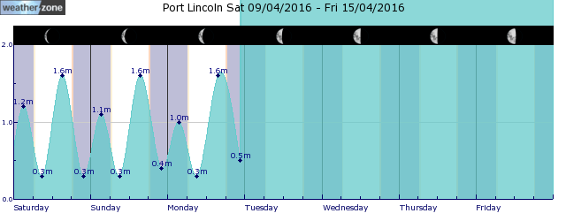
tides for Thevenard
 forecast
South to southeasterly about 10 knots increasing to 10/15 knots in the early afternoon. Seas: Below 1 metre. Swell: Southwesterly 2 metres. Outlook Monday: South to southeasterly 10/15 knots. Seas: Below 1 metre. Swell: Southwesterly 2 metres. Outlook Tuesday: East to southeasterly 10/15 knots. Seas: Below 1 metre. Swell: Southwesterly 1.5/2 metres, tending southerly 1.5/2 metres during the evening.
Issued Sun 05:10 CSTSeas: Up to 1.0m
Swell: Up to 2.0m, SW
forecast winds
Sunday: S/SE increasing 10/15 ktsMonday: S/SE 10/15 kts
Tuesday: E/SE 10/15 kts
- locations
- Coles Pt
- Elliston
- Streaky Bay
- Ceduna
Sun & Moon Times
| first light | sunrise | sunset | last light | moon set | moon rise | moon phase | full moon | last quarter | new moon | first quarter |
|---|---|---|---|---|---|---|---|---|---|---|
|
06:51 CST |
07:18 CST |
17:32 CST |
17:59 CST |
03:52 CST |
15:30 CST |
|
May 23 |
May 31 |
Jun 6 |
Jun 14 |
Shiseido Tahiti Surf Pro forecast
13:40 AEST After an emotional mid-season cut, and an exciting final which saw Australian Jack Robinson claim the win at Margaret River, the World Surf League tour is off to the spectacular and monstrous waves at Teahupo'o in Tahiti, French Polynesia. Teahupo'o was for a long time not even considered a wave, with the mass of the ocean folding over itself into deadly shallow reef.
- 14:36 AEST Go west. Life is warm there.
- 12:56 AEST Sydney feeling no warmer than 10°C this afternoon
- 15:14 AEST Melbourne freezing, Tassie snowing, Sydney basking
- 09:25 AEST Fog blankets Sydney halting ferries


