- WEATHER
Australia
- National
- New South Wales
- Victoria
- Queensland
- Western Australia
- South Australia
- Tasmania
- ACT
- Northern Territory
Long Range Forecasts
- WARNINGS
- RADAR
- SATELLITE
- MAPS & CHARTS
- LONG RANGE
Long Range Forecasts
- CLIMATE
Climate Indicators
- NEWS
Marine Weather
Melbourne Bays Marine Weather Overview
 |
Swell height | Districts with warnings | 3pm forecast wind |
 navigate by marine district
Melbourne Bays
Western Bass Strait
Northern Bass Strait
Eastern Bass Strait
Gippsland Lakes
 most recent warnings
VIC - Sat 10:59 ESTStrong Wind Warning for West, Central and East Gippsland coasts. Cancellation for Port Phillip, Western Port & Central Gippsland Coast
View all current warnings
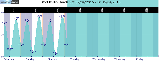
tides for Port Phillip Heads
tides for Geelong
tides for Melbourne
 forecast
North to northwesterly 15/20 knots turning westerly in the middle of the day. Seas: Below 1 metre, increasing to 1/1.5 metres west of Sandy Point by early evening. Outlook Sunday: Westerly 15/20 knots turning southwesterly early in the morning. Winds reaching up to 25 knots west of Sandy Point during the morning. Seas: 1/2 metres, decreasing to 1 metre later in the evening. Outlook Monday: Southwesterly 10/15 knots becoming westerly below 10 knots during the morning then becoming south to southwesterly during the day. Seas: Below 0.5 metres, increasing to around 1 metre west of Sandy Point. Outlook Tuesday: Variable below 10 knots. Seas: Below 1 metre.
Issued Sat 10:00 ESTSeas: Up to 1.5m
Swell: Not available.
forecast winds
Saturday: N/NW 15/20 ktsSunday: SW 25 kts
Monday: SW 10/15 kts
Tuesday: Variable 10 kts
- locations
- Avalon
- Cerberus
- Melbourne Airport
- Moorabbin
- Scoresby
- Viewbank
- Werribee
- Rhyll
- Cranbourne
- Frankston
- Melbourne
Sun & Moon Times
| first light | sunrise | sunset | last light | moon rise | moon set | moon phase | last quarter | new moon | first quarter | full moon |
|---|---|---|---|---|---|---|---|---|---|---|
|
06:57 EST |
07:25 EST |
17:27 EST |
17:55 EST |
00:19 EST |
11:11 EST |
|
Jul 28 |
Aug 4 |
Aug 13 |
Aug 20 |
Snowy weekend ahead in the mountains
16:04 AEST Snowfalls last weekend were the heaviest of the 2024 winter in the alpine regions of Tasmania and mainland Australia, and more snow is coming this weekend.


