- WEATHER
Australia
- National
- New South Wales
- Victoria
- Queensland
- Western Australia
- South Australia
- Tasmania
- ACT
- Northern Territory
Long Range Forecasts
- WARNINGS
- RADAR
- SATELLITE
- MAPS & CHARTS
- LONG RANGE
Long Range Forecasts
- CLIMATE
Climate Indicators
- NEWS
Marine Weather
Melbourne Bays Marine Weather Overview
 |
Swell height | Districts with warnings | 3pm forecast wind |
 navigate by marine district
Melbourne Bays
Western Bass Strait
Northern Bass Strait
Eastern Bass Strait
Gippsland Lakes
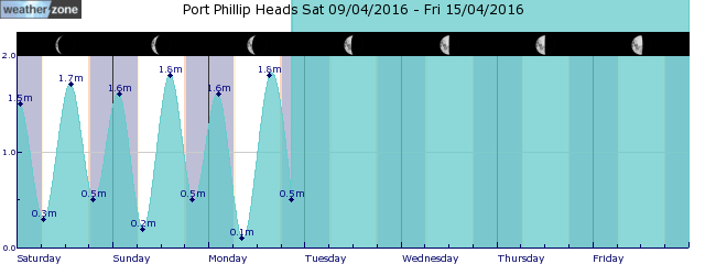
tides for Port Phillip Heads
tides for Geelong
tides for Melbourne
 forecast
North to northwesterly about 10 knots. Seas: Below 0.5 metres. Outlook Monday: Northwesterly 10/15 knots, reaching up to 20 knots west of Sandy Point during the morning. Winds shifting south to southwesterly in the late morning. Seas: Below 1 metre, increasing to 1/1.5 metres west of Sandy Point during the morning. Outlook Tuesday: Southerly 15/20 knots turning southeasterly 10/15 knots in the late afternoon. Seas: Below 1 metre, increasing to around 1 metre west of Sandy Point. Outlook Wednesday: Southeasterly 10/15 knots, decreasing to about 10 knots in the evening. Seas: Below 0.5 metres, increasing to below 1 metre west of Sandy Point.
Issued Sun 16:40 ESTSeas: Up to 0.5m
Swell: Not available.
forecast winds
Sunday: N/NW 10 ktsMonday: NW 20 kts
Tuesday: S 15/20 kts
Wednesday: SE 10/15 kts
- locations
- Avalon
- Cerberus
- Melbourne Airport
- Moorabbin
- Scoresby
- Viewbank
- Werribee
- Rhyll
- Cranbourne
- Frankston
- Melbourne
Sun & Moon Times
| first light | sunrise | sunset | last light | moon set | moon rise | moon phase | last quarter | new moon | first quarter | full moon |
|---|---|---|---|---|---|---|---|---|---|---|
|
06:32 EST |
06:59 EST |
17:32 EST |
18:00 EST |
12:10 EST |
21:12 EST |
|
May 1 |
May 8 |
May 15 |
May 23 |
A quick look at our water storages
12:14 AEST Given the largely clear skies across the country today, it’s a good opportunity to take a look at the water storages of Australia’s major cities. While rainfall is obviously a major contributor to the level of major dams, it is not the only factor.
- 16:15 AEST Signs indicating Australia's cool season arrival
- 07:00 AEST Bonsoy Gold Coast Pro surf forecast
- 14:48 AEST Uncontrolled WA fire causes massive smoke plume
- 11:52 AEST Storms hitting WA as Perth's wait for rain continues


